Gloucester, MA Weather Forecast
Marine Forecast: Massachusetts Bay and Ipswich Bay
Gloucester, Massachusetts
Lat: 42.62N, Lon: 70.66W
Fair
Temp: 37°F
- Humidity:
- 95%
- Winds:
- 6 MPH E
- Gusts:
- N/A MPH
- Barometer:
- 30.48 in.
- Dewpoint:
- 36°F
- Heat index:
- 37°F
- Sunrise:
- 6:20 AM EDT
- Sunset:
- 7:09 PM EDT
- Moonrise:
- 9:14 PM EDT
- Moonset:
- 6:40 AM EDT
| Rest Of Tonight...Cloudy with a 40 percent chance of rain showers. Patchy fog. Near steady temperature in the mid 30s. East winds around 5 mph. |
| Friday...Mostly cloudy. A chance of showers in the morning. Patchy fog in the morning. Not as cool with highs in the lower 60s. South winds 5 to 10 mph with gusts up to 20 mph. Chance of rain 30 percent. |
| Friday Night...Partly cloudy. Patchy fog after midnight. Lows in the mid 40s. Southwest winds 5 to 10 mph with gusts up to 20 mph. |
| Saturday...Partly sunny. Highs in the lower 50s. Temperature falling to around 40 in the afternoon. North winds 5 to 10 mph, becoming east 10 to 15 mph in the afternoon. Gusts up to 25 mph. |
| Saturday Night...Cloudy with a 50 percent chance of rain showers. Patchy fog. Lows in the upper 30s. East winds 5 to 10 mph. Gusts up to 20 mph in the evening. |
| Sunday...Showers. Patchy fog. Highs in the lower 60s. Chance of rain near 100 percent. |
| Sunday Night...Mostly cloudy with a 50 percent chance of showers. Lows in the upper 30s. |
| Monday...Partly cloudy. Highs around 50. Lows in the mid 30s. |
| Tuesday...Partly cloudy. Highs around 50. Lows in the mid 30s. |
| Tuesday Night...Mostly cloudy. Lows in the upper 20s. |
| Wednesday And Wednesday Night...Mostly clear. Highs in the lower 40s. Lows in the lower 30s. |
| Thursday...Mostly sunny. Not as cool with highs in the mid 50s. |
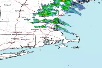 Boston MA Radar
 Northeast Radar
 East Coast Satellite