Chesapeake Bay from North Beach to Drum Point MD Marine Forecast
| Overnight...Sw Winds 10 Kt. Waves 1 Ft. |
| Thu...S Winds 5 To 10 Kt. Gusts Up To 20 Kt In The Late Morning And Afternoon. Waves 1 Ft. |
| Thu Night...Sw Winds 10 Kt With Gusts To 20 Kt... Becoming W Late. Waves 1 Ft. |
| Fri...Nw Winds 5 To 10 Kt. Waves 1 Ft. |
| Fri Night...N Winds 5 Kt. Waves Flat. |
| Sat...E Winds 5 Kt...Becoming Se 10 To 15 Kt With Gusts To 20 Kt In The Afternoon. Waves Flat...Building To 2 Ft In The Afternoon. |
| Sat Night...S Winds 10 To 15 Kt. Gusts Up To 25 Kt In The Evening. Waves 2 Ft. A Chance Of Showers. |
| Sun...Nw Winds 15 To 20 Kt. Waves 2 To 3 Ft. Showers Likely Through The Day, Then A Chance Of Showers In The Evening. |
| Mon...Nw Winds 15 To 20 Kt. Waves 2 To 3 Ft. |
| Area Forecast Discussion National Weather Service Baltimore MD/Washington DC 400am EDT Thu April 16 2026 .WHAT HAS CHANGED... New Small Craft Advisory issued for this afternoon. Special Weather Statement issued for near critical fire weather conditions this afternoon. .KEY MESSAGES... - Record warmth and near critical fire weather conditions expected this afternoon. - Much cooler air returns early next week, along with renewed fire weather concerns. KEY MESSAGE 1...Record warmth and near critical fire weather conditions expected this afternoon. KEY MESSAGE 1 DESCRIPTION... The story remains the same today, record warmth and near critical weather conditions due to upper ridge overhead. However, the upper ridge will start breaking down later today. This is a well known critical fire weather pattern in the western U.S which causes dry thunderstorms in that region of the CONUS. That will not be the case here, but weak capping may allow deep mixing of drier air aloft and stronger winds. Assuming a high of 93 and if dewpoints hold at 52 degrees through the day, this already yields a 25% Rh. Yesterday, we saw RH's dropped into the upper teens at Sawmill Ridge RAWS. Certainly possible that we could see Rh's drop below 20% and winds may gust up to 30 mph if that deeper mixing is realized, although expecting winds to gust generally in the 20 to 25 mph for a few hours in the afternoon. Some showers will start making into the mountains after dark, but will start to fade as they move eastward overnight. Have only a 20% Probability of Precipitation east of the Blue Ridge Mountains with only trace amounts. Dry Fri and Saturday with a continued elevated fire weather conditions. KEY MESSAGE 2...Much cooler air returns early next week, along with renewed fire weather concerns. KEY MESSAGE 2 DESCRIPTION... Gusty northwesterly winds will advect much cooler air into the region on Sunday in the wake of a strong cold frontal passage. Temperatures will either hold steady in the 50s or fall over the course of the day. Morning showers should wind down, giving way to drier conditions during the afternoon. An upper trough axis will pass overhead Sunday night, with a secondary surge of colder air filtering in from the northwest as the trough departs. Temperatures should drop into the 30s for most (lower 40s southeast of I-95), with snow showers possible in the mountains. A stray flurry or two could even be possible to the east of the mountains late Sunday night or early Monday morning. Temperatures are forecast to climb into the 50s for most on Monday (40s mountains, lower 60s central VA to southern MD). Fire weather concerns likely increase as very dry air filters into the region within northwesterly flow. Relative humidity values are forecast to drop into the upper teens and 20s on Monday, with northwesterly winds potentially gusting to between 20 and 30 mph. High pressure is forecast to approach from the northwest Monday night. Depending on the ultimate positioning of the high, there could be frost and/or freeze concerns Monday night if winds go calm. Low temperatures are currently forecast to be in the 30s for most locations. Gradual moderation in temperatures is expected as we move into the middle of the week, with forecast highs in the 60s on Tuesday, and 70s on Wednesday. Relative humidity values may be low again on Tuesday (minimum values in the 20s), but winds will be a bit lighter compared to Monday. Marine SCA (Small Craft Advisory) issued for this afternoon for wind gusts 18-23 kt. Winds diminish late in the evening. SCA (Small Craft Advisory) level winds are expected within northwesterly flow on both Sunday and Monday. Fire Weather Near critical to critical fire weather conditions expected this afternoon. Lack of stronger sustained wind speeds is the only limiting factor for a solid RFW event as fuel moisture, Energy Release Component (ERCs), ongoing moderate to severe drought, and record breaking warmth for the month of April, and low Rh's will likely offset the lack of of strong sustained wind speeds. Even with the lack of strong sustained wind speeds, freq gusts of 20-25 mph are expected with gusts potentially as high as 30 mph if deeper mixing is realized. Otherwise...elevated fire weather conditions will persist through Saturday due to above normal temperatures, low Rh's and lack of rain. Climate Many daily records are likely to be broken this week, for both high temperatures and warm low temperatures. Some stations could tie or set their all-time high temperature and warm low temperature records for the month of April. April 16 Location RECORD HIGH RECORD WARM LOW Washington-National (DCA) 92F (2002) 65F (2017) Washington-Dulles (IAD) 91F (2002) 63F (2017) Baltimore (BWI) 90F (2012) 66F (1941) Baltimore Inner Harbor (DMH) 91F (2012) 65F (2012) Martinsburg (MRB) 90F (2002) 63F (2017) Charlottesville (CHO) 92F (1976) 67F (1941) Annapolis(NAK) 89F (2017) 70F (1994) Hagerstown (HGR) 88F (2002) 62F (2002) April 17 Location RECORD HIGH RECORD WARM LOW Washington-National (DCA) 95F (2002) 65F (2002) Washington-Dulles (IAD) 93F (2002) 59F (2024) Baltimore (BWI) 93F (2002) 66F (1896) Baltimore Inner Harbor (DMH) 95F (2002) 66F (1976) Martinsburg (MRB) 93F (2002) 60F (1941) Charlottesville (CHO) 94F (1976) 65F (1976) Annapolis(NAK) 90F (1976) 68F (1994) Hagerstown (HGR) 90F (2002) 64F (2002) All-Time April Record Highs: Washington-National (DCA) 95F 4/17/2002, 4/18/1976, 4/23/1960 4/27/1915 Washington-Dulles (IAD) 93F 4/6/2010, 4/17/2002, 4/25/1960 Baltimore (BWI) 94F 4/25/1960, 4/23/1960, 4/20/1941, 4/18/1896 Baltimore Inner Harbor (DMH) 98F 4/26/1990, 4/22/1985 Martinsburg (MRB) 96F 4/21/1941 Charlottesville (CHO) 98F 4/24-25/1925 Annapolis(NAK) 95F 4/20/1941 Hagerstown (HGR) 94F 4/6/2010, 4/18/1976, 4/26/1915 All-Time April Record Warm-Lows: Washington-National (DCA) 70F 4/29/2017 Washington-Dulles (IAD) 68F 4/27/2011 Baltimore (BWI) 70F 4/19/1896 Baltimore Inner Harbor (DMH) 76F 4/26/1990 Martinsburg (MRB) 69F 4/19/2025 Charlottesville (CHO) 72F 4/26/1915 Annapolis(NAK) 70F 4/28/1994, 4/16/1994, 4/18/1896 Hagerstown (HGR) 69F 4/27/2009 NOAA Baltimore MD/Washington DC Office: Watches - Warnings - Advisories DC...None. MD...Small Craft Advisory from noon today to 8pm EDT this evening for MDZ008. VA...None. WV...None. Marine Small Craft Advisory from noon today to 8pm EDT this evening for ANZ530>533-535>537-539>541. Small Craft Advisory from noon today to 1am EDT Friday for ANZ534-543. |
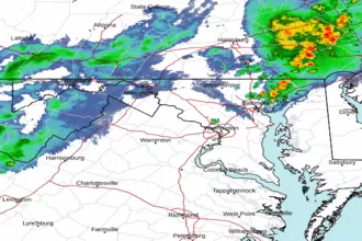 Baltimore/Washington Radar
 Northeast Radar
 East Coast Satellite