Chesapeake Bay north of Pooles Island MD Marine Forecast
| Today...Sw Winds 10 Kt. Waves 1 Ft. |
| Tonight...S Winds 5 To 10 Kt With Gusts To 20 Kt. Waves 1 Ft. |
| Tue...Sw Winds 15 To 20 Kt. Gusts Up To 25 Kt... Increasing To 30 Kt Late. Waves 1 To 2 Ft. |
| Tue Night...S Winds 15 To 20 Kt With Gusts To 30 Kt. Waves 2 Ft. A Chance Of Showers. |
| Wed...S Winds 15 To 20 Kt With Gusts To 25 Kt. Waves 2 Ft. Showers. |
| Wed Night...Nw Winds 5 To 10 Kt. Waves 1 Ft. Showers Likely With A Chance Of Tstms. |
| Thu...Nw Winds 5 To 10 Kt. Waves 1 Ft. Showers Likely. A Chance Of Showers After Midnight. |
| Fri...W Winds 5 To 10 Kt. Waves 1 Ft Or Less. Winds And Waves Higher And Visibilities Lower In And Near Tstms. |
| Area Forecast Discussion National Weather Service Baltimore MD/Washington DC 330am EDT Monday May 4 2026 .WHAT HAS CHANGED... Winds across the waters were increased as southerly gusts exceed Small Craft Advisory criteria through midweek. Otherwise, no major changes were made to the forecast. .KEY MESSAGES... - 1) Warming temperatures and mountain rain showers expected today and tomorrow. - 2) A strong cold front brings widespread rainfall midweek, followed by cooler temperatures. KEY MESSAGE 1...Warming temperatures and mountain rain showers expected today and tomorrow. High pressure shifts offshore through Tuesday night with return flow ushering in warmer temperatures. High pressure remains overhead as a cold front approaches from the northwest. Primarily dry conditions are expected each day with the exception being rain showers and an occasional thunderstorm possible mainly west of I-81. Minimal cloud cover and gusty winds are expected today as high temperatures rise into the 70s for most with higher elevations staying in the mid 60s. Temperatures continue warming tomorrow with highs in the 70s to mid 80s. Cloud cover increases from northwest to southeast as the aforementioned cold front tracks from the Ohio River valley to just northwest of the forecast area. KEY MESSAGE 2...A strong cold front brings widespread rainfall midweek, followed by cooler temperatures. A deep upper level trough forms over the Great Lakes and begins to track through the region on Wednesday, bringing widespread rainfall potentially through late Thursday. Early Quantitative Precipitation Forecast estimates are still ranging between 0.5-1.25 inches of rainfall during this period, with the ECMWF (European Centre for Medium-Range Weather Forecasts) trending higher than the GFS (Global Forecast System) as of the 12Z/18Z runs. The severe thunderstorm risk has trended less likely over the last 24 hours, with NCAR's Medium-Range Convective Hazards and CSU's Medium- Range Convective forecasts placing most of the Mid-Atlantic outside of their 5%-15% probability areas for now. Regardless, any rainfall will be widely beneficial for the area given current drought concerns. Temperatures begin to drop again once this front passes through, with highs for Thursday largely ranging in the 50s and low 60s. Temperatures could begin to increase slightly again going into next weekend. Another frontal system is forecast to track across the forecast area this weekend, bringing additional rain chances to the region. Marine A Small Craft Advisory remains in effect across most of the waters until 11am this morning with gusts up to 20 knots expected. Additionally, a Small Craft Advisory is in effect for the upper and middle portions of the tidal Potomac this afternoon as winds gust 20 knots inland. Southerly channeling will lead to increased winds across the water tonight with additional SCAs (Small Craft Advisories) likely through Wednesday afternoon. Gusts decrease to 15-20 knots on Thursday but will still likely range above SCA (Small Craft Advisory) levels. Southerly winds shift northerly by Thursday morning. Tides / Coastal Flooding Tidal anomalies rise through this morning with Annapolis nearing minor flood stage during the high tide cycle this morning. The current forecast has the Annapolis tidal site staying under minor flood stage, although we will continue to monitor. NOAA Baltimore MD/Washington DC Office: Watches - Warnings - Advisories DC...None. MD...None. VA...None. WV...None. Marine Small Craft Advisory until 11am EDT this morning for ANZ531>534-537-539>541-543. Small Craft Advisory from noon today to 7pm EDT this evening for ANZ535-536. |
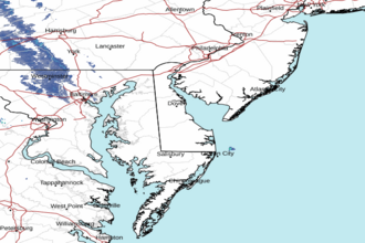 Dover DE Radar
 Northeast Radar