Jupiter Inlet to Deerfield Beach, FL out 20nm Marine Forecast
| Today...Ne Winds 25 To 30 Kt, Diminishing To 20 To 25 Kt Late. Seas 7 To 10 Ft, Occasionally To 13 Ft. Wave Detail: Ne 10 Ft At 8 Seconds And Nw 2 Ft At 7 Seconds. Intracoastal Waters Very Rough In Exposed Areas. |
| Tonight...E Winds 20 To 25 Kt With Gusts Up To 30 Kt. Seas 5 To 8 Ft, Occasionally To 10 Ft. Wave Detail: E 8 Ft At 7 Seconds And Nw 2 Ft At 7 Seconds. Intracoastal Waters Rough In Exposed Areas. |
| Wed...E Winds 15 To 20 Kt With Gusts Up To 25 Kt. Seas 5 To 7 Ft, Occasionally To 9 Ft, Subsiding To 3 To 5 Ft, Occasionally To 6 Ft In The Afternoon. Wave Detail: E 6 Ft At 6 Seconds And Nw 2 Ft At 7 Seconds, Becoming E 5 Ft At 6 Seconds And Nw 2 Ft At 7 Seconds. Intracoastal Waters Choppy In Exposed Areas. |
| Wed Night...E Winds 15 To 20 Kt. Seas 3 To 5 Ft, Occasionally To 6 Ft. Wave Detail: E 4 Ft At 5 Seconds And Nw 1 Foot At 7 Seconds. Intracoastal Waters Choppy In Exposed Areas. |
| Thu And Thu Night...E Winds 10 To 15 Kt. Seas 2 To 4 Ft, Occasionally To 5 Ft. Wave Detail: E 3 Ft At 5 Seconds And Nw 1 Foot At 7 Seconds. Intracoastal Waters A Moderate Chop. |
| Fri Through Sat...S Winds 10 To 15 Kt. Seas 2 To 3 Ft. Wave Detail: Se 2 Ft At 5 Seconds And Nw 1 Foot At 7 Seconds. Intracoastal Waters Light Chop. |
| Area Forecast Discussion National Weather Service Miami FL 406am EDT Tuesday April 21 2026 ...New SHORT TERM, LONG TERM, Marine EACHES,Fire Weather .KEY MESSAGES... Updated at 316am EDT Tuesday April 21 2026 - A cold front will move further south of the area today and allow for strong high pressure to establish across the region, bringing periods of breezy and gusty winds today. - Hazardous marine conditions continue today in the wake of the front. - Relative humidity values will drop into the 35-40% range this afternoon mainly over interior and western areas of South Florida. .SHORT TERM... (Today through Wednesday) Issued at 316am EDT Tuesday April 21 2026 Models and surface analyses show a synoptic scenario dominated by an expanding high pressure across the SE CONUS and Florida in the wake of a FROPA. The ridge axis will remain north of SoFlo, while the frontal boundary continues to push further south into Cuba and the central Gulf waters today. This will bring a drier air mass across the area, with pressure gradients tightening up between the front to the south and the high pressure to the north. Therefore, expect generally NE winds to gradually increase today with potential for gusts into the 25-30 mph range. Coastal locations right along the Atlantic coastline may experience even higher gusts at times. These conditions will also result in several marine hazards affecting the beaches and the Atlantic coastal waters. For more details, please refer to the Marine section below. A few showers may still develop over the southern-most portions of the CWA, then rain activity should end by the late morning hours. Cooler and drier air advection will prevail this afternoon with relative humidity values dropping into the 35-40% range over much of central/western SoFlo. Please see the Fire Weather section below for more details about fire hazards today. For Wednesday, expect the drier trend to continue, while pressure gradients start to relax. This will bring a downward trend in wind speeds by the afternoon hours. The cooler airmass and the persisting ENE winds will keep afternoon highs in the upper 70s over much of the eastern half of SoFlo, and low to mid 80s elsewhere. Long Term (Wednesday night through Monday) Issued at 316am EDT Tuesday April 21 2026 Long range solutions remain fairly persistent in depicting an upper level disturbance developing over the SE CONUS and moving into the Gulf for the Thu-Fri time frame. Latest ensembles show an associated low level feature also developing over the Gulf, but remaining very weak. The added moisture and instability may bring low-end Probability of Precipitation coverage (15-25%) each day, with best chances Friday afternoon, and Quantitative Precipitation Forecast values in the half inch range or lower. GFS (Global Forecast System) and Euro bring a weak frontal boundary into the SE CONUS and northern Florida to start the weekend, although it remains uncertain how far south the front may reach. Regardless, the arrival of the boundary will push a ridge of high pressure into the western Atlantic, and further relaxing winds over SoFlo through Sunday. Light winds or even calm periods are possible Sunday afternoon, with overall flow acquiring a southerly component ahead of the front. Combined with daytime heating, this may favor a few showers and thunderstorms, mainly over interior and northern portions of SoFlo each afternoon. Then conditions may begin to dry again early next week behind the departing front. Temperatures should remain slightly cooler than normals through Friday, with afternoon highs along east coast locations in the upper 70s, and morning lows over interior areas in the low 60s. A gradual warming will follow during the weekend, with afternoon highs in the upper 80s across most areas, and morning lows in the upper 60s to lower 70s. Marine Issued at 316am EDT Tuesday April 21 2026 Hazardous boating conditions continue today in the wake of a frontal passage. A few showers and thunderstorms are still possible, mainly over the Atlantic waters, through the late morning hours. Breezy and gusty NE winds will prevail today with hazardous conditions due to seas building up to 8-11 ft over the Atlantic and wind speeds of 20kt or higher. Gulf seas will range from 3-6 ft. Beaches Issued at 316am EDT Tuesday April 21 2026 Strong onshore flow and will promote a high risk of rip currents across the Atlantic coastline through the middle of the week. An increasing swell will also bring high surf along the Palm Beach coastline for which a high surf advisory is in effect. Fire Weather Issued at 316am EDT Tuesday April 21 2026 Drier air and breezy northeasterly winds will continue to establishing across the area today behind a frontal passage, and exacerbate the fire weather conditions. Latest model data brings possible relative humidity values down to the 35-40 percent range over interior and west areas of South Florida this afternoon. The 20 ft winds may reach the 15-20mph range at times, along with FPFs in the 2.6-3.4 range. There remains a marginal concern for fire weather conditions for those areas, and a Fire Weather Watch remains in effect. NOAA Miami FL Office: Watches - Warnings - Advisories FL...Fire Weather Watch from 11am EDT this morning through this evening for FLZ069. High Rip Current Risk through Wednesday morning for FLZ168-172- 173. High Surf Advisory until 8pm EDT this evening for FLZ168. AM...Small Craft Advisory until 2pm EDT this afternoon for AMZ610. Small Craft Advisory until 11am EDT Wednesday for AMZ630-650- 651-670-671. GM...Small Craft Advisory until 8am EDT Wednesday for GMZ656-657-676. |
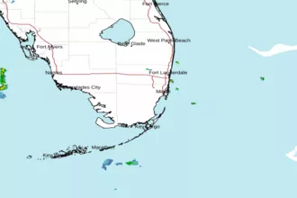
 Miami FL Radar
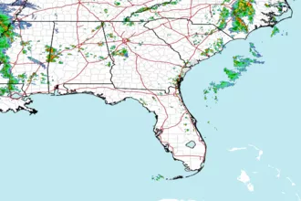
 Southeast Radar