St. Augustine to Flagler Beach, FL Out 20 NM Marine Forecast
| Rest Of Today...Northeast Winds 5 To 10 Knots, Becoming East 10 To 15 Knots This Afternoon. Seas 2 To 4 Feet, Occasionally To 5 Feet. Wave Detail: Northeast 3 Feet At 8 Seconds And Southeast 2 Feet At 5 Seconds. Intracoastal Waters A Moderate Chop. |
| Tonight...Southeast Winds 10 To 15 Knots. Seas 2 To 4 Feet, Occasionally To 5 Feet. Wave Detail: East 4 Feet At 8 Seconds And Southeast 2 Feet At 4 Seconds. Intracoastal Waters A Moderate Chop. |
| Tuesday...Southeast Winds 5 To 10 Knots, Increasing To 10 To 15 Knots In The Afternoon. Seas 2 To 3 Feet. Wave Detail: Southeast 3 Feet At 6 Seconds. Intracoastal Waters A Moderate Chop. |
| Tuesday Night...South Winds 10 To 15 Knots. Seas 2 To 3 Feet. Wave Detail: Southeast 3 Feet At 7 Seconds. Intracoastal Waters A Moderate Chop. |
| Wednesday...South Winds Around 10 Knots, Becoming Southeast 15 To 20 Knots In The Afternoon. Seas 2 To 4 Feet, Occasionally To 5 Feet. Wave Detail: Southeast 3 Feet At 4 Seconds And East 3 Feet At 7 Seconds. Intracoastal Waters Choppy. |
| Wednesday Night...South Winds 15 To 20 Knots, Becoming Southwest 10 To 15 Knots After Midnight. Seas 3 To 4 Feet, Occasionally To 5 Feet. Wave Detail: Southeast 4 Feet At 6 Seconds. Intracoastal Waters Choppy. |
| Thursday...Southeast Winds 10 To 15 Knots. Seas 2 To 3 Feet. Intracoastal Waters A Moderate Chop. A Chance Of Showers With A Slight Chance Of Thunderstorms. Winds And Waves Higher In And Near Thunderstorms. |
| Friday...Southeast Winds 10 To 15 Knots. Seas 2 To 3 Feet. Intracoastal Waters A Moderate Chop. A Chance Of Showers With A Slight Chance Of Thunderstorms. Winds And Waves Higher In And Near Thunderstorms. |
| Area Forecast Discussion National Weather Service Jacksonville FL 737am EDT Monday May 4 2026 Made a few changes to the temps and dewpoints this morning based on the cool morning lows in the 40s to lower 50s (below guidance). Otherwise, little change in the forecast for today, with sunny skies except for a few cumulus around the coastal areas and inland northeast FL, and high clouds mostly in southeast GA. High pressure shifting further away from the area this afternoon and tonight will bring more boundary layer flow from the southeast and a further warming trend going into Tuesday. Near Term - Through Tonight Main Highligheights This Period: - Critically Low Relative Humidity Values Across Inland Southeast GA and the Suwannee Valley this Afternoon - Elevated Fire Danger Conditions Possible on Tuesday Afternoon at Inland Locations - Moderate Risk of Rip Currents at All Area Beaches Overnight surface analysis depicts high pressure (1021 millibars) situated along the southeast U.S. coast. Meanwhile, a wavy frontal boundary remains stalled across the FL Keys and northwestern Bahamas. Aloft...a subtle shortwave trough was crossing our area, with this feature embedded within a mostly zonal west-northwesterly flow pattern that prevails across the eastern two-thirds of the nation. Latest GOES-East derived Total Precipitable Water imagery indicates that a dry air mass continues to advect into our region, with PWAT (Precipitable Water) values around one half inch or less across southeast GA and northeast FL, while values of 0.5 - 0.75 inches were located across north central FL. The aforementioned shortwave trough crossing our area was creating isentropic lift / overrunning across central and south FL to the north of stalled, wavy frontal boundary. This lift was creating a deck of mostly mid level cloud cover for locations along and south of Interstate 4 in central FL, with a few stratocumulus clouds nosing into north central FL. Fair skies otherwise prevail across our region, with decoupling winds at most inland locations and a light onshore breeze prevailing along the northeast FL coast. Temperatures at 07Z ranged from the mid 40s across portions of inland southeast GA to the 50s for inland locations elsewhere, except mid 60s for portions of north central FL. 60s prevail at coastal locations, and dewpoints ranged from the mid 40s across inland southeast GA to the mid and upper 50s for coastal northeast FL as well as portions of north central FL. Shortwave troughing crossing our area early this morning will quickly shift offshore before noon, with zonal westerly flow in its wake becoming northwesterly overnight as ridging over Mexico begins to expand over the Bay of Campeche (southwestern Gulf). Meanwhile, high pressure situated along the southeastern seaboard will shift eastward today, allowing low level flow to shift from east- northeasterly this morning to east-southeasterly by this evening. This veering flow will slowly erode the dry air mass that is in place across our area by this evening, with PWATs (Precipitable Waters) climbing to near 1 inch this afternoon across north central FL. Breezy onshore winds associated with the Atlantic sea breeze boundary will push marine cumulus and stratocumulus onshore this afternoon from around St. Augustine southward, with increasing clouds expected through around sunset across north central FL and southern portions of the Suwannee Valley as the Atlantic sea breeze boundary propels inland. A few showers or sprinkles may develop from this cumulus and stratocumulus deck just south of our area this morning through the afternoon, but dry conditions will otherwise prevail for our region through tonight. Plenty of sunshine and the initially very dry air mass in place at inland locations will allow highs to rebound to the low and mid 80s for locations west of the I- 95 corridor this afternoon, while breezy onshore winds keep coastal highs in the upper 70s. Southeasterly breezes will be slow to subside tonight at coastal locations, keeping lows mostly in the low to mid 60s, while decoupling winds at inland locations allow lows to fall into the 50s. Short Term - Tuesday Through Wednesday Night Main Highligheights This Period: - Dry Weather with Warming Temperatures - Moderate Rip Current Risk at Area Beaches Predominantly dry weather conditions will persist through Tuesday and Wednesday while high pressure over the region moves off towards the east with the prevailing flow shifting to become more out of the west by the end of the period as a cold front boundary presses in towards the forecast area from out of the northwest. Temperatures will warm through midweek with daily high temps rising from out of the mid to upper 80s on Tuesday up into the lower to mid 90s by Wednesday. Overnight low temperatures will similarly warm from out of the lower 60s up into the mid to upper 60s by midweek. Long Term - Thursday Through Sunday Main Highligheights This Period: - Hot & Breezy Wednesday and Thursday - Shower & T'storm Chances Return Thursday, Especially for Southeast GA - Slightly Cooler Late Week with Scattered Shower Potential for Northeast FL High pressure will shift further south and east of the region on Wednesday as the next front approaches from the north Wednesday Night, likely moving across southeast GA Thursday and Thursday Night before slowing progress near or south of northeast FL Counties on Friday with weakening also likely. High pressure tries to build in from the north behind the front, but as of now it looks fairly weak and ridging doesn't look to make it much further than southern GA, and therefore at least slight chances for showers and t'storms are likely to continue across northeast FL late week where the warmest temps and best moisture remains in place closer to wherever the frontal boundary ultimately sets up/lingers. Temperatures will be above climo for Wednesday and Thursday area-wide, dropping overall closer to normal for Friday and into the start of next week with more of a north/south gradient likely. Marine High pressure centered over the southeastern states will shift offshore this afternoon as weak low pressure situated along a stationary frontal boundary moves eastward and away from Bahamas. Breezy east to southeasterly winds are expected during the afternoon and evening hours today and again on Tuesday. Caution level speeds will be possible on Wednesday afternoon and evening, well in advance of a cold front that will be entering the southeastern states. Winds will shift to southerly on Wednesday night and then southwesterly on Thursday as the frontal boundary slowly approaches our local waters from the northwest. Showers and thunderstorms will likely accompany this frontal passage on Thursday afternoon and evening, with strong storms possible across the Georgia waters. Breezy northwesterly winds are expected in the wake of this frontal passage on Thursday night, followed by winds shifting to northerly on Friday morning and then northeasterly by Friday afternoon as the frontal boundary likely stalls over the Florida peninsula. Additional rounds of showers and thunderstorms will be possible from Friday through the upcoming weekend as a wave of low pressure develops along the stalled frontal boundary that should be positioned near the northeast Florida waters. Rip Currents Breezy onshore winds will combine with a lingering east-northeasterly ocean swell to maintain a higher end moderate risk at area beaches today. The ocean swell will gradually fade by midweek, but persistently breezy southeasterly winds will keep a moderate risk in place at area beaches through midweek. Gusty southwesterly winds may reduce this risk on Thursday. Fire Weather - Critically Low Relative Humidity Values Across Inland Southeast GA and the Suwannee Valley this Afternoon - Marginally High Daytime Dispersion Values this Afternoon Across North Central FL - An Elevated Fire Danger and High Dispersions Inland Each Afternoon Tuesday Through Thursday Dry weather is expected to prevail area-wide through Wednesday as high pressure remains in control. With the drier airmass behind the recent front, very good mixing inland each day through Wednesday will result in minRH near critically low values during the afternoon and evening, as well as an overall increase in daytime dispersions each day. Flow will be generally our of the north to northeast today to nearly variable but still gusty over inland GA, becoming increasing more east to southeasterly through Wednesday. The next frontal boundary to affect the area will approach Wednesday Night, bring chances of rain mainly for southeast GA on Thursday with lower chances across northeast FL as the front weakens Thursday Night and into Friday. Thunderstorms will also be possible with the front, especially north of about the I-10 corridor. FOG POTENTIAL AND OTHER REMARKS: Patchy to areas of fog will be possible at inland locations during the predawn and early morning hours on Wednesday. Climate Record High Temperatures at NE FL/SE GA climate sites for: Wed, May 6: JAX: 96/2012 CRG: 96/2012 GNV: 96/1955 AMG: 95/2012 Thu, May 7: JAX: 94/1977 CRG: 94/1977 GNV: 96/1955 AMG: 93/1962. NOAA Jacksonville FL Office: Watches - Warnings - Advisories FL...None. GA...None. Marine None. |
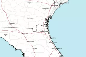 Jacksonville Radar
 Southeast Radar