Cape Mendocino to Point Arena CA out 10 NM Marine Forecast
| Today...Nw Wind 20 To 25 Kt. Gusts Up To 35 Kt This Afternoon. Seas 8 Ft. Wave Detail: Nw 8 Ft At 9 Seconds And W 3 Ft At 13 Seconds. |
| Tonight...Nw Wind 20 To 25 Kt. Seas 10 Ft. Wave Detail: Nw 9 Ft At 11 Seconds. |
| Sat...Nw Wind 15 To 20 Kt. Seas 8 Ft. Wave Detail: Nw 8 Ft At 9 Seconds And Nw 4 Ft At 13 Seconds. |
| Sat Night...Nw Wind 5 To 10 Kt. Seas 7 Ft. Wave Detail: Nw 7 Ft At 9 Seconds And Nw 6 Ft At 18 Seconds. |
| Sun...Sw Wind 5 Kt. Seas 6 Ft. Wave Detail: Nw 6 Ft At 9 Seconds And W 4 Ft At 17 Seconds. A Chance Of Showers. |
| Sun Night...S Wind 5 Kt. Seas 6 Ft. Wave Detail: Nw 6 Ft At 15 Seconds. A Chance Of Showers. |
| Mon...S Wind 5 Kt. Seas 6 Ft. Wave Detail: Nw 6 Ft At 14 Seconds. A Chance Of Showers. |
| Mon Night...Nw Wind 5 Kt. Seas 5 Ft. Wave Detail: W 5 Ft At 13 Seconds And S 1 Foot At 16 Seconds. Patchy Fog. A Chance Of Rain. |
| Tue...Nw Wind 5 To 10 Kt. Seas 4 Ft. Wave Detail: W 4 Ft At 12 Seconds And Sw 2 Ft At 15 Seconds. |
| Tue Night...Nw Wind 5 To 10 Kt. Seas 4 Ft. Wave Detail: Nw 2 Ft At 6 Seconds And W 4 Ft At 12 Seconds. |
| Area Forecast Discussion National Weather Service Eureka CA 1207am PDT Fri May 1 2026 Synopsis Warm conditions continue today before temperatures cool this weekend. Friday and Saturday will see isolated thunderstorms over the interior mountains with broader and stronger storm potential Sunday. .KEY MESSAGES... -Warm and mostly dry conditions will continue today with a weak marine layer near shore -Isolated thunderstorms (10-15% chance) over the eastern interior this afternoon and Saturday afternoon. -Scattered and possibly strong thunderstorms (15-25% chance) over the the interior Sunday afternoon with some storms pushing closer to shore. A weak shortwave approaching the area today and into the weekend will bring somewhat unsettled conditions. Increased marine influence and cloud cover will slightly cool interior temperatures with highs mostly in the mid 70s by Saturday. Lower pressure will help lift the marine layer onshore, though most models show at least some marine stratus sticking around. The greatest impact of the shortwave will be the potential for thunderstorms over the interior. Beginning this afternoon, daytime CAPE values will begin to approach 1000 J/Kg over the eastern interior. Precipitable water, however, will be very marginal generally between 0.6 and 0.8 inches. Such factors will combine to create isolated thunderstorms (10 to 15% chance) over the interior. Chances will be greatest and far eastern Trinity, Mendocino, and Lake Counties along the rim of the Sacramento Valley. Very similar conditions are expected Saturday, but with a shift northwards towards interior Del Norte, interior Humboldt, and Trinity Counties. The shortwave will morph into a cutoff low and travel down along the California coast Saturday into Sunday. Tropical air wrapping up the Sacramento valley will bring much more moisture to the area with precipitable water over 1.2 inches. Combined with increasing wind shear and still solid CAPE, the chances for thunderstorms will be much greater on Sunday. Storm chances over the interior are around 25% with greater potential for storms to push east to west into the coast (10 to 15% chance of storms along the Humboldt and Del Norte Coast). Some of the storms over the interior hold the potential to be severe with strong outflow winds and isolated damaging hail. Storms are most likely to be wet, so much so that NBM currently places a 0.1 to 0.3 inches of rain all across the northern half of the area on Sunday. Storms will likely leave behind cooler and cloudier conditions for next Monday, though moisture and clouds will generally limit any overnight frost or freeze concerns. Generally calm and warm conditions will most likely build mid week. Ensembles are hinting at ridging weakening later next week, potentially bringing additional chances for showers and thunderstorms. Marine Northerly winds continue to be strengthened over the waters, along with steep seas. Steep seas of 7 to 9 ft are pulsing into the inners as well. Near gale to gale conditions will periodically develop over the waters through Saturday morning. Gale strength gusts will be more persistent around and south of Cape Mendocino. Hazardous Seas Warnings remain over the outer zones to cover the periods of gales and large, steep seas. Conditions hazardous to small crafts are forecast for the inner zones for winds up to 21 kts of steep seas of 7 to 10 ft. An area of low pressure will approach the area Saturday, and the northerly winds will subside through Saturday evening. This will begin an extended period of lighter winds and smaller seas which is likely to carry into next week. An up to 21 second small, long period westerly swell will begin filling in Saturday afternoon. The swell is forecast to peak late Sunday at 4 to 7 ft at 16 seconds. .BEACH HAZARDS...On Sunday, a long period northwest swell with periods between 16-19 seconds will arrive. This swell continues to be monitored as it may pose a moderate risk of sneaker waves for coastal areas. A Beach Hazard Statement has been issued starting Saturday night through late Sunday evening. Sneaker waves are anomalously large, unexpected waves that sweep across beaches without warning. There can be up to 30 minutes of smaller waves before a sneaker wave arrives to the shoreline. Choose your recreation wisely by avoiding steep beaches and jetties as well as staying much farther back from the ocean than normal. Never turn your back on the ocean! JB .EKA WATCHES/WARNINGS/ADVISORIES... CA... Beach Hazards Statement from Saturday evening through Sunday evening for CAZ101-103-104-109. NORTHWEST CALIFORNIA COASTAL WATERS... Small Craft Advisory until 9am PDT Saturday for PZZ450-455. Hazardous Seas Warning until 9am PDT Saturday for PZZ470- 475. For forecast zone information see the forecast zone map online: https://www.weather.gov/images/eka/zonemap.png |
 Eureka CA Radar
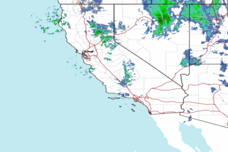
 Pacific Southwest Radar