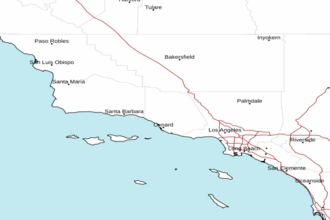
East Santa Barbara Channel from Pt. Conception to Pt. Mugu CA including Santa Cruz Island Marine Forecast
| Today...W Wind 5 To 10 Kt, Becoming 10 To 20 Kt With Gusts To 25 Kt This Afternoon. Seas 2 To 3 Ft. Wave Detail: W 2 Ft At 5 Seconds. |
| Tonight...W To Nw Wind 15 To 25 Kt. Seas 3 To 4 Ft. Wave Detail: W 4 Ft At 5 Seconds. |
| Thu...Western Portion, Nw Wind 20 To 30 Kt Becoming W In The Afternoon. Eastern Portion, Nw Wind 10 To 15 Kt Becoming W 15 To 25 Kt In The Afternoon. Seas 3 To 4 Ft, Building To 4 To 6 Ft. Wave Detail: Nw 5 Ft At 6 Seconds. |
| Thu Night...Western Portion, Nw Wind 25 To 30 Kt Becoming N 10 To 15 Kt After Midnight. Eastern Portion, W Wind 15 To 20 Kt Becoming N 5 To 10 Kt After Midnight. Seas 5 To 7 Ft, Subsiding To 3 To 5 Ft. Wave Detail: Nw 6 Ft At 7 Seconds. |
| Fri...Eastern Portion, Ne Wind 15 To 25 Kt. Western Portion, Nw Wind 5 To 10 Kt. Seas 2 To 4 Ft. Wave Detail: W 3 Ft At 11 Seconds. |
| Fri Night...Nw Wind 10 To 15 Kt, Becoming N 5 To 10 Kt After Midnight. Seas 2 To 3 Ft. Wave Detail: W 2 Ft At 11 Seconds. |
| Sat...Eastern Portion, E Wind 10 To 20 Kt. Western Portion, N Wind 5 To 10 Kt. Seas 2 To 3 Ft. Wave Detail: Nw 2 Ft At 11 Seconds. |
| Sat Night...Nw Wind 5 To 10 Kt. Seas 2 To 3 Ft. Wave Detail: W 2 Ft At 10 Seconds. |
| Sun...Light Winds, Becoming Sw 5 To 10 Kt In The Afternoon. Seas 2 To 3 Ft. Wave Detail: W 2 Ft At 10 Seconds. |
| Sun Night...W Wind 10 To 15 Kt. Seas 2 To 4 Ft. Wave Detail: Nw 3 Ft At 5 Seconds, W 2 Ft At 10 Seconds And S 2 Ft At 15 Seconds. |
| Area Forecast Discussion ...UPDATED National Weather Service Los Angeles/Oxnard CA 841am PDT Wednesday April 1 2026 Synopsis 01/1247 AM. It will be cooler today with a clearing skies. Gusty north to northeast winds will develop tonight and last through Saturday. A moderate Santa Ana is possible Friday and Saturday. Much warmer temperatures with mostly sunny skies are expected this weekend. Short Term - Today through Friday 01/840 AM. ***UPDATE*** Quite the overperforming rainfall event last night especially across coastal and valley locations of Ventura and LA county. Total rainfall amounts averaged 0.25-0.75" with isolated spots over an 1". The far interior (including the antelope valley) ranged from 0.1"-0.25". NWS OXNARD measured 1.14" of rain. Rainfall rates were also impressive with pockets of 0.75" to nearly an inch - Notably across the Oxnard/Camarillo area. ***From Previous Discussion*** A cold front currently over LA county will move out of the area just before dawn. Skies will slowly clear through the day. There is a weak post frontal trough that may bring a brief morning shower to SLO county. The front will bring in a little more cool air than was expected ydy and max temps will fall 2 to 4 degrees despite additional afternoon sunshine. Most max temps will end up in the 60s today across the csts/vlys or 4 to 8 degrees under normals. There will be increasing offshore flow from the north this evening and overnight. Mtn winds 30 to 40 mph are likely but no advisories are anticipated. Dry fairly fast moving NW flow will be over the area Thursday. Skies will be sunny. The brisk upper flow will bring gusty winds to the mtns and the Antelope Vly. Most cst/vly locations will see a couple of degrees of warming and this will bring some lower 70 degree readings to the vlys. The interior will cool 2 to 4 degrees as cooler air from the San Joaquin Vly is brought in by the northerly flow. On Thursday night a good north push arrive and low end advisory gusts of 40-50 MPH across the I-5 Corridor and the Santa Barbara county mountains will likely develop. Towards dawn the north push will turn to the NE as high pressure builds into the Great Basin. About 5 mb of offshore flow from both the N and E will develop. This rapid increase in offshore flow will likely create low end advisory level gusts from 35 to 45 mph with some local gusts to 55 mph in the mtns. At the upper levels a ridge will build into the state and hgts will rise to 576 dam. Skies will be sunny and this along the rising hgts and offshore flow will kick off a big warm up. Almost all sites will see 8 to 10 degrees of warming with max temps reaching into the 70s and lower 80s, which is about 4 to 8 degrees above normal. Long Term - Saturday through Tuesday 01/323 AM. Weak ridging is on tap for the weekend. Hgts will not climb too high, however, only reaching ~576 dam. Offshore flow will remain although it will be weaker than it was on Friday. Skies will be mostly clear through the period. It will be a warm weekend, for sure, with max temp warming and additional 2 to 4 degrees on Saturday. The coastal areas will cool some Sunday as the weakening offshore flow allows for an earlier seabreeze. Inland areas will see another 2 to 4 degrees of warming. Max temps over the weekend will be in the 70s across the csts and lower to mid 80s across the vlys. On Monday a trough will push the ridge to the east and hgts will fall. The offshore flow turns onshore and this will lead to 3 to 6 degrees of cooling across the board. Despite this cooling max temps will end up 4 to 8 degrees above normal. There is some disagreement on the upper level pattern on Tuesday. The GFS (Global Forecast System) has more of a trough like pattern while the EC favors ridging. The ensembles lean towards the EC and brings 2 to 4 degrees of warming to most areas. The AI-GFS is dry through the next 14 days. The AI-EC however does show a system in the area around the 11th. Both models continue to indicate continued above normal max temps. Marine 01/736 AM. High confidence in winds and seas staying under Small Craft Advisory (SCA) levels through this morning. A few isolated post frontal showers could linger through the afternoon north of Pt Concpetion SCA (Small Craft Advisory) winds with a chance of low-end GALES is expected to develop for the coastal waters south of Point Conception (including nearshore and the Santa Barbara Channel) this evening and overnight. These winds will become widespread Thursday and will last through Friday morning. Expecting seas to build quickly on Thursday, peaking Thursday night. Seas could reach SCA (Small Craft Advisory) levels 10-12 feet over the outer waters and inner waters north of Point Sal. Seas for the southern inner waters could peak around 4 to 7 feet. Wave heigheights should drop off rather quickly as winds shift to the northeast Friday morning. NOAA Los Angeles/Oxnard CA Office: Watches - Warnings - Advisories CA...NONE. PZ...Small Craft Advisory in effect from 9am Thursday to 3am PDT Friday for zone 645. Small Craft Advisory in effect from 2pm this afternoon to 3 am PDT Friday for zone 650. Small Craft Advisory in effect from 3am Thursday to 11 AM PDT Friday for zones 670-673. Small Craft Advisory in effect from 6pm this evening to 11 am PDT Friday for zone 676. |
 Los Angeles Radar
 Pacific Southwest Radar