Tidal Potomac from Cobb Island MD to Smith Point VA Marine Forecast
| Today...N Winds 10 Kt With Gusts To 20 Kt. Waves 1 To 2 Ft. A Slight Chance Of Showers. |
| Tonight...N Winds 10 To 15 Kt With Gusts To 20 Kt. Waves 1 To 2 Ft. |
| Sun...Nw Winds 10 To 15 Kt With Gusts To 20 Kt. Waves 2 Ft. |
| Sun Night...S Winds 5 To 10 Kt. Waves 1 Ft. |
| Mon...Sw Winds 5 To 10 Kt. Waves 1 Ft. |
| Mon Night...S Winds 10 To 15 Kt With Gusts To 20 Kt. Waves 1 To 2 Ft. |
| Tue...S Winds 15 To 20 Kt. Waves 2 To 3 Ft. |
| Wed...S Winds 15 To 20 Kt. Waves 2 Ft. A Chance Of Showers. Showers Likely After Midnight. |
| Area Forecast Discussion National Weather Service Baltimore MD/Washington DC 1031am EDT Sat May 2 2026 .WHAT HAS CHANGED... Although winds over the Potomac River and Chesapeake Bay have diminished some over the past few hours, there are still a few places encountering winds gusting up to 20 knots at times. Therefore, a Marine Weather Statement is in effect for another half hour or so in theNear Term - Rest Of Today Through Tonight cast. Tidal anomalies have decrease below threshold at Annapolis; therefore, the Coastal Flood Advisory has expired. No major changes were made to the forecast. The Freeze Watch remains in effect for tonight. Looking ahead, computer models are leaning toward a more aggressive cold front around Thursday of next week that could bring a few strong thunderstorms to the region. It is too early to tell to what extent, but the overall pattern of low pressure and cold fronts and high pressure positions are favoring this scenario. .KEY MESSAGES... - 1) Freeze Watch remains in effect for tonight with below normal temperatures expected across the forecast area. - 2)Showers remain possible at times next week as temperatures rise to near or above normal. Heavier showers and a thunderstorm could be in the picture for Thursday. KEY MESSAGE 1...Freeze Watch remains in effect for tonight with below normal temperatures expected across the forecast area. A Freeze Watch remains in effect for tonight with low temperatures in the upper 20s to low 30s along the Alleghenies. Low temperatures will be in the 30s to mid 40s across the forecast area, although winds blowing 5 to 10 knots will inhibit frost development. That being said, frosty conditions are possible west of the Blue Ridge where low temperatures will be in the low 30s and winds will be light in the valleys. Overall, below average temperatures are expected this afternoon and tomorrow with high temperatures in the 50s to 60s. Overnight low temperatures drop into the 30s and 40s each night. Primarily dry conditions are expected each day as a coastal low tracks off the coast of the Carolinas. Any precipitation associated with the area of low pressure should remain southeast of the forecast area. KEY MESSAGE 2...Showers remain possible at times next week as temperatures rise to near or above normal. Heavier showers and a thunderstorm could be in the picture for Thursday. Zonal flow takes over in the upper levels once this weekend's trough passes through. By Monday, temperatures should rise back into the mid-70s across much of the area and continue to increase into the midweek. By then, a trough originating over the Plains will approach the region, bringing with it a cold frontal boundary and renewed chances for showers and thunderstorms starting Tuesday evening and going into Wednesday. As this trough passes through, daily chances for rain and thunderstorms exist, with the strongest chances for convective activity currently Thursday, where NCAR's Medium Range Convective AI Forecast shows the area in the 5%-15% probability range at this time. Upper level zonal flow again takes over towards the end of next week once this cold front moves through. Marine Winds diminish below SCA (Small Craft Advisory) criteria around midday until tonight when a coastal low tracks nearby. Northwest winds gust 20 to 25 knots across the waters tonight with additional SCAs (Small Craft Advisories) likely. Winds shift to southerly on Monday with a Small Craft Advisories likely. Small Craft Advisories remain likely Tuesday as southwest winds flow. Sustained 20 knot winds are expected on Tuesday. South winds are expected on Wednesday with SCA (Small Craft Advisory) criteria conditions expected. Tides / Coastal Flooding Winds have shifted to northwesterly with anomalies expected to fall through the day. NOAA Baltimore MD/Washington DC Office: Watches - Warnings - Advisories DC...None. MD...Freeze Watch from late tonight through Sunday morning for MDZ501-509-510. VA...Freeze Watch from late tonight through Sunday morning for VAZ503-504. WV...Freeze Watch from late tonight through Sunday morning for WVZ501-503-505-506. Marine None. |
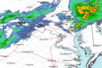 Baltimore/Washington Radar
 Northeast Radar
 East Coast Satellite